
What is a Derecho Wind Storm? How It Differs From a Tornado
A derecho is not an ordinary thunderstorm or a tornado: it is a widespread, long-lived convective windstorm that carves a continuous path of severe straight-line wind damage spanning at least 400 miles. Often referred to by meteorologists as an “inland hurricane,” a derecho produces sustained winds exceeding 58 mph with localized bursts topping 100 to 140 mph, capable of flattening millions of acres of crops and knocking out metropolitan power grids for weeks.
The term “derecho” was first coined in 1888 by Dr. Gustavus Hinrichs, a physics professor at the University of Iowa, who noted that unlike circular tornadoes (from the Spanish tornar, meaning to turn), these damaging storms moved straight ahead (from the Spanish derecho, meaning straight). Today, the NOAA Storm Prediction Center (SPC) enforces strict scientific criteria to distinguish official derechos from ordinary squall lines.
Tornadoes damage neighborhood blocks in spirals; derechos level entire states with straight-line wall-of-wind acceleration.
The Official NOAA SPC Criteria for a Derecho
To be categorized as a derecho by NOAA meteorologists, a convective storm system must satisfy four non-negotiable thresholds:
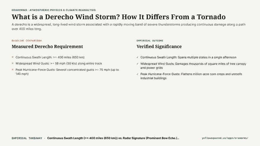
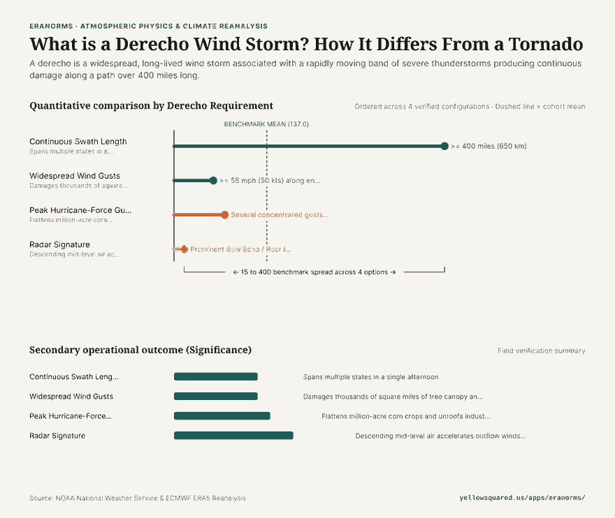
- Continuous Swath Length (>= 400 Miles / 650 km): The storm complex must generate a concentrated path of damaging wind reports spanning at least 400 miles along its major axis.
- Severe Wind Floor (>= 58 mph / 50 kts): Severe wind gusts must occur along virtually the entire length of the damage track rather than occurring as an isolated burst.
- Hurricane-Force Peaks (>= 75 mph / 65 kts): The storm must produce multiple, well-separated occurrences of significant severe wind gusts exceeding 75 mph. During the historic August 10, 2020 Midwest Derecho, wind gusts reached an astonishing 140 mph in Cedar Rapids, Iowa.
- Rapid Forward Speed (50 to 70 mph): The bow echo complex races across the landscape at highway speeds, giving residents downstream minimal advance warning.
The Physics of the Bow Echo: Why the Winds Accelerate
On radar imagery, derechos appear as distinctive curved lines shaped like an archer’s bow, known as a bow echo. This bow structure is driven by an atmospheric engine known as the Rear Inflow Jet (RIJ).
As rain and hail evaporate in the mid-troposphere behind the leading convective line, intense evaporative cooling makes the air exceptionally dense. This cold air plunges toward the ground and pulls fast mid-level jet stream momentum downward with it. When this high-velocity downdraft slams into the earth, it has nowhere to go but forward, creating devastating straight-line winds that push the center of the storm line outward into a bow.
Derecho vs. Tornado: Key Differences
| Characteristic | Derecho | Tornado |
|---|---|---|
| Wind Direction | Straight-line (all trees fall in the same direction) | Rotational (debris scattered in spiral patterns) |
| Damage Footprint | 400 to 1,000+ miles long; 50 to 100 miles wide | Typically 1 to 20 miles long; 50 to 500 yards wide |
| Duration | 6 to 18 hours across multiple states | Few minutes to 1 hour |
| Radar Feature | Broad bow echo with Rear Inflow Jet | Hook echo and Velocity Couplet / TVS |
How to Prepare for a Severe Convective Wind Event
- Treat severe thunderstorm warnings with tornado urgency: When the National Weather Service mentions a “destructive derecho” or “winds in excess of 80 mph,” move immediately to an interior room on the lowest floor.
- Clear outdoor hazards: High-speed straight-line winds turn patio furniture and trampolines into dangerous projectiles.
- Explore historical climate and severe storm data: Review historical convective weather patterns and storm metrics at Eranorms.