
What Is an Atmospheric River and How Much Rain Does It Carry?
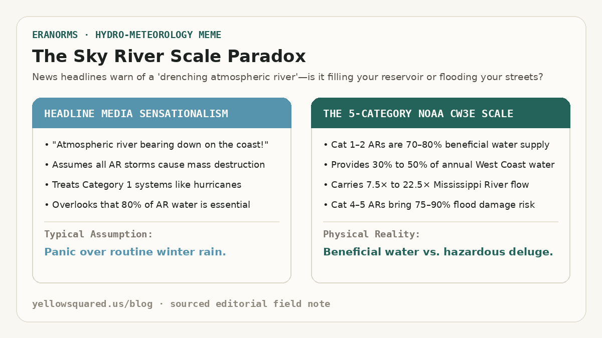
When weather forecasts announce that an atmospheric river is headed toward the West Coast, news broadcasts often treat it like an oncoming hurricane. In reality, atmospheric rivers are essential conveyor belts of moisture that fill drinking water reservoirs and build winter mountain snowpack. According to hydro-meteorological observations from the NOAA Office of Atmospheric Research and the NOAA Physical Sciences Laboratory (PSL), an average atmospheric river transports an amount of water vapor equivalent to 7 to 15 times the entire flow of liquid water exiting the mouth of the Mississippi River. Rather than flowing over land, this river travels three to ten thousand feet in the air across corridors hundreds of miles wide and thousands of miles long.
Along the western coast of North America, just 3 to 7 atmospheric river storms each winter account for 30% to 50% of the region's annual precipitation. Without them, states like California, Oregon, and Washington face crippling multi-year droughts; with too many back-to-back, swollen rivers breach levees and trigger widespread mudslides.
An atmospheric river is not a tropical cyclone; it is a narrow, fast-moving filament of water vapor in the sky that carries more water than the largest river on Earth.
How Atmospheric Rivers Form Over the Pacific Ocean
Atmospheric rivers originate over the warm, tropical waters of the central and western Pacific. Strong winds in the lower troposphere—associated with mid-latitude cyclones—draw warm, moisture-laden air into a long, narrow filament known as a low-level jet. These filaments typically stretch 1,200 to 2,000 miles long while remaining only 250 to 350 miles wide.
As this moisture corridor hurtles eastward toward the coast, it encounters mountainous coastal terrain such as the California Coast Ranges, the Sierra Nevada, and the Cascades. When the fast-moving water vapor slams into these mountains, it has nowhere to go but up. Meteorologists call this orographic lift: as the air rises up the mountain slopes, it expands, cools, and condenses rapidly into torrential rain at low elevations and feet of dense snow across high peaks.
The 5-Category Atmospheric River Scale: Rainmaker vs. Flood Hazard
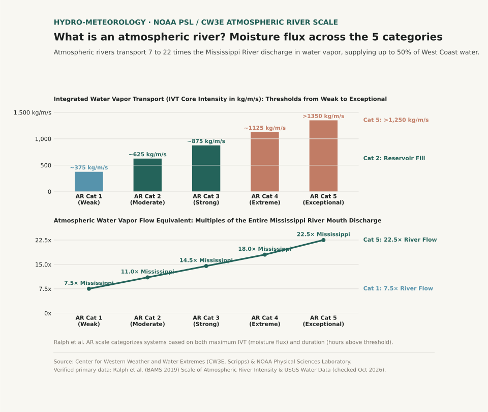
To help the public distinguish between drought-busting rain and dangerous storm surges, meteorologists at the Center for Western Weather and Water Extremes (CW3E, Scripps) and USGS created the 5-category Ralph et al. Atmospheric River Scale. Unlike hurricane ratings that measure surface wind speed, the AR scale measures two microphysical variables: Integrated Water Vapor Transport (IVT) in kilograms of water per meter per second, and duration (the number of consecutive hours an area remains under the core plume).
| AR Category | Classification | Core IVT Intensity | Water Vapor Volume | Typical Duration | Community & Ecological Impact |
|---|---|---|---|---|---|
| Category 1 | Weak | 250 – 500 kg/m/s | ~7.5× Mississippi River | 24 – 36 hours | Primarily beneficial; gentle drought relief and snowpack replenishment |
| Category 2 | Moderate | 500 – 750 kg/m/s | ~11.0× Mississippi River | 24 – 48 hours | Mostly beneficial (70%); solid reservoir storage with localized street ponding |
| Category 3 | Strong | 750 – 1,000 kg/m/s | ~14.5× Mississippi River | 36 – 60 hours | Equal balance of hazard and benefit; minor river flooding, rapid snowmelt |
| Category 4 | Extreme | 1,000 – 1,250 kg/m/s | ~18.0× Mississippi River | 48 – 72 hours | Mostly hazardous (75%); widespread river flooding, washed-out roads, mudslides |
| Category 5 | Exceptional | > 1,250 kg/m/s | > 22.5× Mississippi River | 60+ hours | Primarily hazardous (90%); catastrophic flooding, levee breaches, and dam overflows |
A Category 2 atmospheric river fills reservoirs without causing major property damage; a Category 5 atmospheric river dumps twenty-two times the Mississippi River for three straight days onto saturated ground.
Why Atmospheric River Duration Matters as Much as Intensity
A storm with an IVT of 900 kg/m/s that sweeps through your city in 18 hours is classified as an AR Cat 2 because the ground has time to absorb the runoff. If that exact same 900 kg/m/s plume stalls against the mountains for 48 hours under a persistent atmospheric blocking ridge, it gets upgraded to an AR Cat 4. Once soil reaches saturation, every additional inch of rain turns directly into surface runoff, driving mountain streams into residential valleys.
Want to track how seasonal moisture corridors and temperature departures shift year after year in your region? Open Eranorms in your browser or Download Eranorms for iPhone and Get Eranorms on Android to explore historical rainfall records, station departures, and climate normals for any U.S. city.