
Why Are Idaho, Oregon, and Kansas Split Across Two Time Zones?
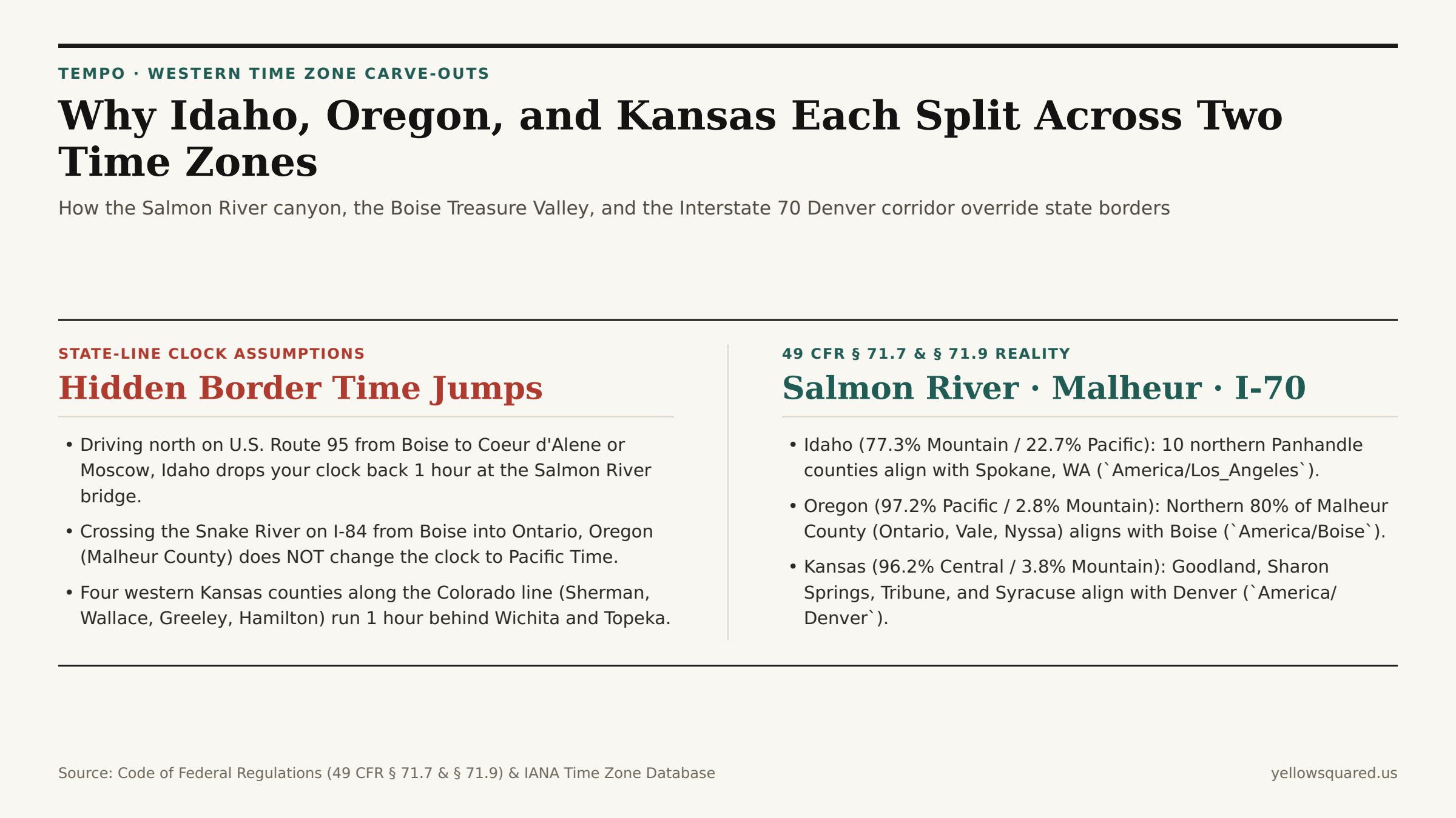
Look at a time zone map of the western United States and three state lines immediately break ranks with their neighbors: northern Idaho detaches from Boise to join Seattle and Spokane on Pacific Time; one county in eastern Oregon detaches from Portland to join Boise on Mountain Time; and four counties along the western edge of Kansas detach from Wichita to join Denver on Mountain Time. Each of these cross-state splits is codified in federal law under Title 49, Part 71 of the Code of Federal Regulations (49 CFR § 71.7 and § 71.9).
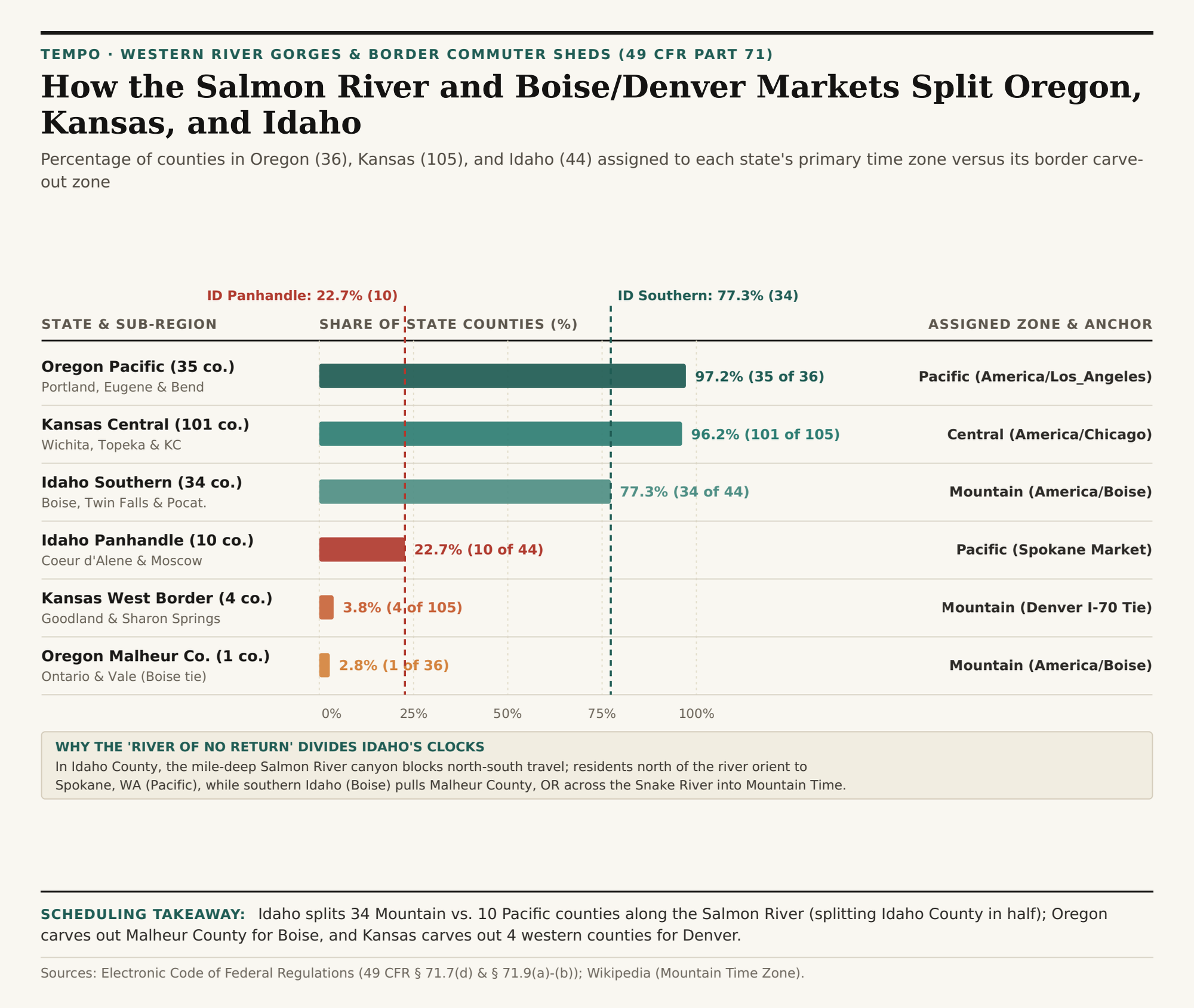
Across the three states, the U.S. Department of Transportation assigns 34 of Idaho's 44 counties (77.3%) to Mountain Time and 10 northern Panhandle counties (22.7%) to Pacific Time; 35 of Oregon's 36 counties (97.2%) to Pacific Time and Malheur County (2.8%) to Mountain Time; and 101 of Kansas's 105 counties (96.2%) to Central Time alongside 4 Colorado-border counties (3.8%) on Mountain Time. To check live clock offsets across any of these split-state corridors right now, Open Tempo in your browser.
1. Why the Salmon River Splits Idaho (and Divides Idaho County in Half)
Under 49 CFR § 71.9(b) and documented in Mountain Time Zone Statutory Boundary Records, the dividing line between Mountain Time (America/Boise) and Pacific Time (America/Los_Angeles) enters Idaho from the Montana border and follows the main channel of the Salmon River (famous as the "River of No Return") west to the Snake River canyon at the Oregon border.
The reason for this mid-state split is rugged topography and rail history. The Salmon River gorge cuts a mile-deep granite barrier across central Idaho; only a single winding two-lane highway (U.S. Route 95) links southern Idaho to the northern Panhandle. Because the 10 northern counties (Benewah, Bonner, Boundary, Clearwater, Kootenai, Latah, Lewis, Nez Perce, Shoshone, and the northern part of Idaho County) were settled via the transcontinental railroads running through Spokane, Washington — just 30 miles west of Coeur d'Alene — Congress and the DOT placed the entire northern Panhandle on Pacific Time (UTC-8 / PDT UTC-7). Remarkably, Idaho County is split in two by the river: its county seat of Grangeville sits north of the Salmon River on Pacific Time, while Riggins sits inside the canyon south of the bridge on Mountain Time.
2. Why Oregon's Malheur County Runs on Boise Mountain Time
Cross the Snake River heading west on Interstate 84 from southern Idaho into Ontario, Oregon, and you might expect your clock to drop back an hour from Mountain Time to Pacific Time. Instead, the clock stays on Mountain Time for another 60 miles. Under 49 CFR § 71.9(a), the northern four-fifths of Malheur County, Oregon (north of latitude 42°27'N, encompassing Ontario, Vale, Nyssa, and Adrian) is legally assigned to Mountain Time (America/Boise). Because Ontario sits on the western edge of the irrigated Treasure Valley agricultural basin — where farmers, hospitals, television stations, and retail commuters all anchor to Boise, Nampa, and Caldwell — keeping Malheur County on Mountain Time prevents a daily clock jump across the Snake River bridges.
"Only the sparsely populated southern tip of Malheur County (around McDermitt on the Nevada border) drops back to Pacific Time, making Malheur County one of the few counties in the United States split between two time zones by a line of latitude."
3. Kansas's Four Interstate 70 Mountain Time Counties
In Kansas, 49 CFR § 71.7(d) places 101 of the state's 105 counties (96.2%) on Central Time (America/Chicago), even though the western half of Kansas lies west of the 97.5°W solar meridian. However, four counties stacked along the Colorado border — Sherman (Goodland), Wallace (Sharon Springs), Greeley (Tribune), and Hamilton (Syracuse) — petitioned to remain on Mountain Time (America/Denver) so their grain elevators, hospitals, and broadcast markets stay synchronized with eastern Colorado and Denver along the Interstate 70 and U.S. Route 50 corridors.
| State & Sub-Region | 49 CFR Part 71 Boundary | Counties | State Share | Observed Time Zone | Primary Metro / Market Anchor |
|---|---|---|---|---|---|
| Oregon Pacific Majority | All except northern Malheur Co. | 35 of 36 | 97.2% | Pacific (UTC-8 / UTC-7) | Portland, Eugene, Bend & Medford |
| Oregon Malheur Carve-Out | Malheur Co. north of 42.45°N | 1 of 36 | 2.8% | Mountain (UTC-7 / UTC-6) | Ontario, Vale & Boise Treasure Valley |
| Kansas Central Majority | East of Sherman/Wallace/Greeley/Hamilton | 101 of 105 | 96.2% | Central (UTC-6 / UTC-5) | Wichita, Topeka & Kansas City |
| Kansas Western Border | Sherman, Wallace, Greeley, Hamilton | 4 of 105 | 3.8% | Mountain (UTC-7 / UTC-6) | Goodland, Syracuse & Denver I-70 Corridor |
| Idaho Southern Majority | South of Salmon River (49 CFR 71.9b) | 34 of 44 | 77.3% | Mountain (UTC-7 / UTC-6) | Boise, Twin Falls, Idaho Falls & Pocatello |
| Idaho Northern Panhandle | North of Salmon River canyon | 10 of 44 | 22.7% | Pacific (UTC-8 / UTC-7) | Coeur d'Alene, Moscow & Spokane WA |
Checking County-Level Clocks Before You Book
Whether you are coordinating a university call with Moscow, Idaho (Pacific) and Boise (Mountain), or scheduling freight stops along I-84 in Ontario, Oregon (Mountain) and I-70 in Goodland, Kansas (Mountain), city-level IANA lookups eliminate border guesswork. Open Tempo in your browser to compare live clocks across all three split states, and download the 49 CFR Part 71 county split CSV table.