
Why Are North Dakota, South Dakota, and Nebraska Split Between Central and Mountain Time?
Look at a highway map of the northern Great Plains and the state borders of North Dakota, South Dakota, and Nebraska form three stacked horizontal rectangles. Yet their clocks refuse to follow state lines: under Title 49, Section 71.7 of the Code of Federal Regulations (49 CFR § 71.7), all three states are split between Central Time (UTC-6 / CDT UTC-5) in the east and Mountain Time (UTC-7 / MDT UTC-6) in the west.
Across the 212 counties of the three states, federal commerce rules place 45 of North Dakota's 53 counties (84.9%) on Central Time vs. 8 southwest counties (15.1%) on Mountain Time; 48 of South Dakota's 66 counties (72.7%) on Central Time vs. 18 western counties (27.3%) on Mountain Time; and 75 of Nebraska's 93 counties (80.6%) on Central Time vs. 18 western Panhandle and southwest counties (19.4%) on Mountain Time. To check exact county-level UTC offsets before scheduling calls or freight across the Plains, Open Tempo in your browser.
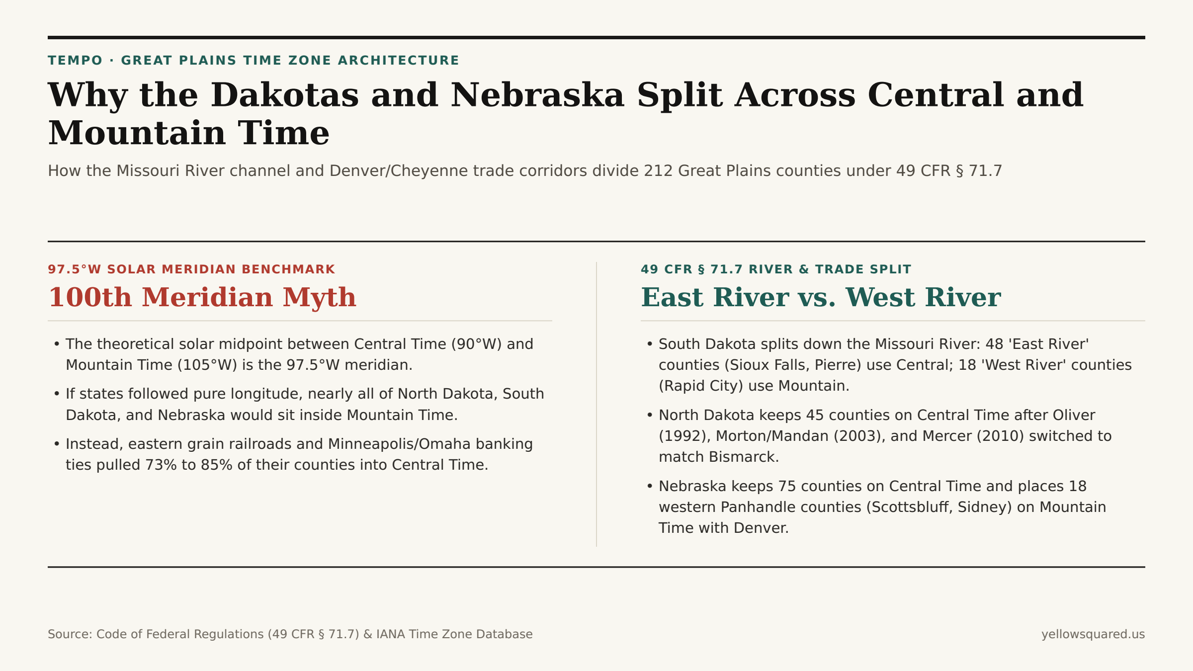
1. South Dakota's "East River" vs. "West River" Cultural and Clock Divide
In South Dakota, the time zone boundary defined in 49 CFR § 71.7(b) and detailed in Mountain Time Zone Statutory Records follows the main channel of the Missouri River from the North Dakota border south to Pierre, then steps west around Lyman, Gregory, and Tripp counties to the Nebraska border. Residents use two everyday terms that simultaneously describe geography, ranching vs. farming economics, and clock time:
- "East River" (48 Counties, 72.7% — Central Time,
America/Chicago): Encompasses Sioux Falls, Aberdeen, Brookings, Mitchell, Yankton, and the state capital of Pierre (along with three counties immediately west of the river — Stanley, Lyman, and Gregory — that petitioned to stay on Central Time with Pierre and Chamberlain). - "West River" (18 Counties, 27.3% — Mountain Time,
America/Denver): Encompasses Rapid City, Deadwood, Sturgis, Spearfish, the Black Hills, and the Badlands, aligning western South Dakota with Wyoming and Denver trade corridors.
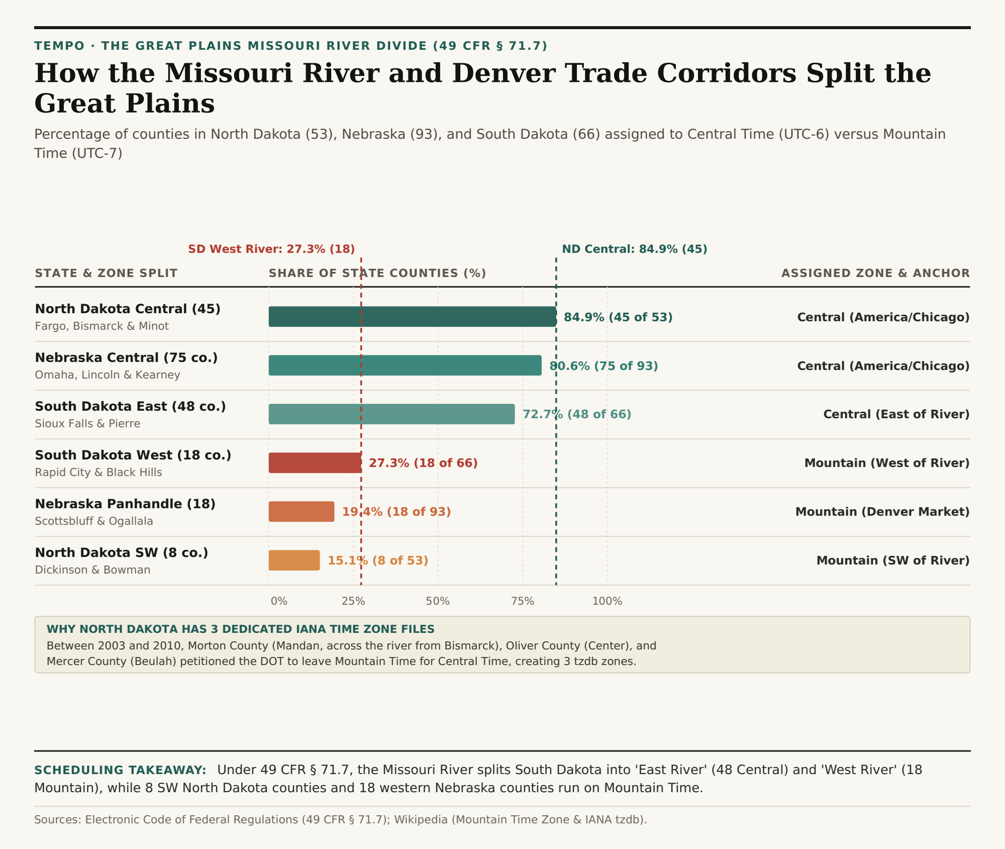
UTC-6) and Mountain Time (UTC-7) across North Dakota, Nebraska, and South Dakota under 49 CFR § 71.7. Download the Great Plains county split dataset (CSV).2. Why North Dakota Has Three Dedicated America/North_Dakota/* IANA Zones
In North Dakota, 49 CFR § 71.7(a) originally used the Missouri River as the dividing line between Central Time in the east (Fargo, Grand Forks, Minot, and Bismarck on the east bank) and Mountain Time in the southwest (Dickinson, Bowman, and Hettinger). However, because Bismarck sits directly on the east bank of the Missouri River, workers living just across the river in Mandan (Morton County) or in nearby coal and power-plant counties faced a daily one-hour time jump. Over an 18-year span, three county petitions redrew the boundary and forced the IANA Time Zone Database (tzdb) to create three dedicated historical zones:
America/North_Dakota/Center(Oliver County): Switched from Mountain Time to Central Time in October 1992.America/North_Dakota/New_Salem(Morton County, except the far western strip): Switched from Mountain Time to Central Time in October 2003 so Mandan and New Salem matched neighboring Bismarck.America/North_Dakota/Beulah(Mercer County): Switched from Mountain Time to Central Time in November 2010, leaving only 8 southwest counties (Adams, Billings, Bowman, Golden Valley, Hettinger, Slope, Stark, and south-bank McKenzie/Dunn/Sioux segments) on Mountain Time.
"Because Mandan and Bismarck sit on opposite banks of the Missouri River, Morton County's 2003 DOT petition eliminated a one-hour clock jump across a two-mile commuter bridge."
3. Nebraska's 75 Central vs. 18 Mountain Panhandle Split
In Nebraska, 49 CFR § 71.7(c) places 75 eastern and central counties (80.6%) — including Omaha, Lincoln, Grand Island, Kearney, and North Platte — on Central Time (America/Chicago). The western boundary steps down the western edges of Cherry (partially split), Thomas, McPherson, Lincoln, Hayes, and Hitchcock counties, placing 18 western Panhandle and southwest counties (19.4%, including Scottsbluff, Alliance, Sidney, Chadron, and Ogallala) on Mountain Time (America/Denver) so their agricultural, hospital, and broadcast schedules match nearby Cheyenne, Wyoming, and Front Range Colorado.
| State & Sub-Region | 49 CFR § 71.7 Boundary | Counties | State Share | Observed Time Zone | Primary Commercial Anchor |
|---|---|---|---|---|---|
| North Dakota Central | East/North of Missouri + 3 counties | 45 of 53 | 84.9% | Central (UTC-6 / UTC-5) | Fargo, Bismarck, Grand Forks & Minot |
| North Dakota Southwest | Southwest of Missouri River | 8 of 53 | 15.1% | Mountain (UTC-7 / UTC-6) | Dickinson, Bowman & Badlands |
| Nebraska Central | East of Keith/Perkins/Chase line | 75 of 93 | 80.6% | Central (UTC-6 / UTC-5) | Omaha, Lincoln, Kearney & North Platte |
| Nebraska Panhandle | 18 Western Counties (49 CFR 71.7c) | 18 of 93 | 19.4% | Mountain (UTC-7 / UTC-6) | Scottsbluff, Sidney, Alliance & Ogallala |
| South Dakota East River | East of Missouri River channel | 48 of 66 | 72.7% | Central (UTC-6 / UTC-5) | Sioux Falls, Aberdeen & Pierre |
| South Dakota West River | West of Missouri River | 18 of 66 | 27.3% | Mountain (UTC-7 / UTC-6) | Rapid City, Deadwood & Black Hills |
Coordinating Schedules Across Interstate 80, I-90, and I-94
Long-haul drivers and logistics planners crossing the Great Plains on I-94 (near Dickinson, ND), I-90 (at the Missouri River bridge near Chamberlain, SD), or I-80 (between North Platte and Ogallala, NE) cross the Central-to-Mountain boundary mid-state. Open Tempo in your browser to check live local times across every county along your route, and download the 49 CFR § 71.7 Great Plains county split CSV.