
Why Does the Democratic Republic of the Congo Have Two Time Zones (Kinshasa UTC+01:00 vs. Lubumbashi UTC+02:00)?
Look at a time-zone map of Africa and one country immediately stands out: the Democratic Republic of the Congo (DRC) is the only sovereign nation on the African continent that divides its territory into two standard time zones year-round. According to historical and legislative records summarized in Time in the Democratic Republic of the Congo, the country's 10 western provinces—including the national capital, Kinshasa—observe West Africa Time (WAT, UTC+01:00, IANA identifier Africa/Kinshasa), while its 16 eastern and southern provinces—including the copper-belt hub of Lubumbashi and the Great Lakes city of Goma—observe Central Africa Time (CAT, UTC+02:00, IANA identifier Africa/Lubumbashi), where roughly 59% of the Congolese population resides.
Why didn't the DRC merge into a single national clock like Algeria, Nigeria, or Kazakhstan? The answer lies in pure equatorial solar geometry: the DRC spans 2,344,858 km² from 12°12'E on the Atlantic coast to 31°16'E along Lake Albert—straddling the exact theoretical reference meridians for both UTC+01:00 (15°00'E) and UTC+02:00 (30°00'E). Open Tempo in your browser to compare live clocks between Africa/Kinshasa and Africa/Lubumbashi alongside your local time zone.
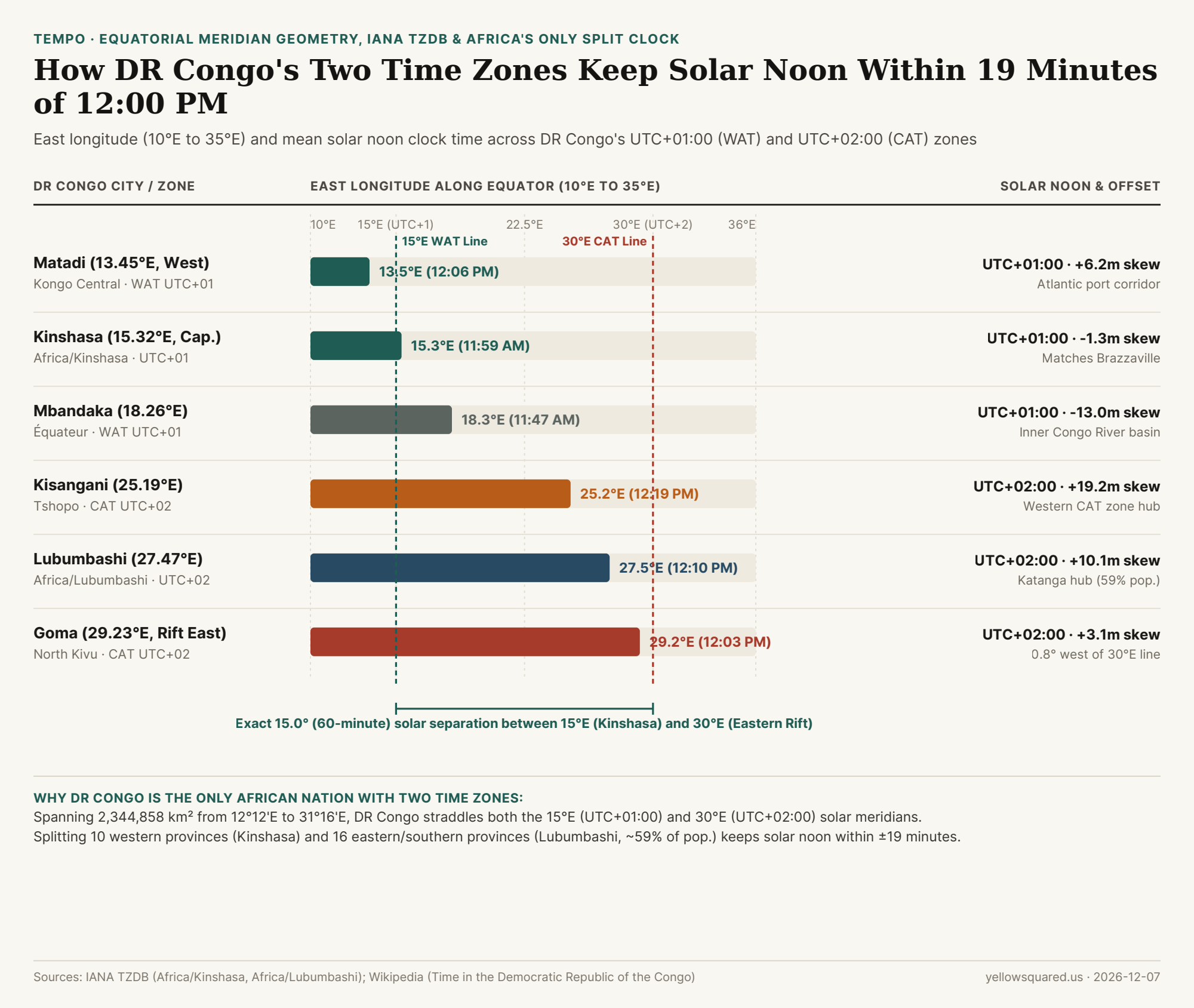
12°E to 31°E) and mean solar noon clock time across the Democratic Republic of the Congo's western UTC+01:00 (Africa/Kinshasa) and eastern UTC+02:00 (Africa/Lubumbashi) time zones. Source: Time in the Democratic Republic of the Congo · Download CSV dataset.The 15°E and 30°E Equatorial Meridian Fit
Because Earth rotates 360° in 24 hours, every 15° of east longitude corresponds to exactly 60 minutes of solar time (4.0 minutes per degree). Unlike high-latitude countries where seasonal daylight swings from 8 hours in winter to 16 hours in summer, the DRC sits squarely astride the Equator (between 5°N and 13°S), where day and night last roughly 12 hours each all year long and neither zone observes Daylight Saving Time.
"Kinshasa sits at 15°19'E—just 0.32 degrees (78 seconds of solar time) east of the exact 15°00'E reference meridian for UTC+01:00—while Goma on the eastern border sits at 29°14'E, just 0.77 degrees west of the 30°00'E reference meridian for UTC+02:00."
This geographic alignment produces one of the tightest solar-noon fits on Earth:
- Western Zone (
WAT, UTC+01:00,Africa/Kinshasa): Covers the 10 western provinces (Kinshasa, Kongo Central, Kwango, Kwilu, Mai-Ndombe, Équateur, Mongala, Nord-Ubangi, Sud-Ubangi, and Tshuapa). In Kinshasa (15.32°E), mean solar noon occurs at11:59 AM(-1.3 minutesskew), keeping sunrise near6:00 AMand sunset near6:00 PMyear-round. Crucially, staying onUTC+01:00keeps Kinshasa synchronized with Brazzaville (15.28°E, Republic of the Congo) directly across the Congo River—the closest pair of national capitals in the world outside Rome/Vatican City. - Eastern & Southern Zone (
CAT, UTC+02:00,Africa/Lubumbashi): Covers 16 provinces across Kasaï, Maniema, Katanga, Orientale/Tshopo, and North/South Kivu, home to roughly 59% of the national population. In Lubumbashi (27.47°E), solar noon falls at12:10 PM(+10.1 minutesskew), while in Goma (29.23°E) it hits12:03 PM(+3.1 minutesskew), matching neighboring Rwanda, Burundi, Zambia, and South Africa onUTC+02:00.
City-by-City Solar Noon & IANA TZDB Reference Table
The table below details the exact east longitude, IANA time-zone identifier, reference meridian, and mean solar noon clock time across six major Congolese cities (download the raw CSV table):
| DRC City & Province | IANA TZDB Zone | Longitude | Official Offset | Mean Solar Noon | Solar Skew | Cross-Border & Regional Alignment |
|---|---|---|---|---|---|---|
| Matadi (Kongo Central) | Africa/Kinshasa |
13.45°E |
UTC+01:00 (WAT) |
12:06 PM | +6.2 min |
Atlantic port corridor; matches Angola (UTC+01:00) |
| Kinshasa (Capital) | Africa/Kinshasa |
15.32°E |
UTC+01:00 (WAT) |
11:59 AM | -1.3 min |
Sits on 15°E meridian; matches Brazzaville across river |
| Mbandaka (Équateur) | Africa/Kinshasa |
18.26°E |
UTC+01:00 (WAT) |
11:47 AM | -13.0 min |
Inner Congo River basin near the 0°00' Equator line |
| Kisangani (Tshopo) | Africa/Lubumbashi |
25.19°E |
UTC+02:00 (CAT) |
12:19 PM | +19.2 min |
Western hub of the UTC+02:00 zone along upper Congo River |
| Lubumbashi (Haut-Katanga) | Africa/Lubumbashi |
27.47°E |
UTC+02:00 (CAT) |
12:10 PM | +10.1 min |
Copper-belt capital; matches Zambia & South Africa (UTC+02:00) |
| Goma (North Kivu) | Africa/Lubumbashi |
29.23°E |
UTC+02:00 (CAT) |
12:03 PM | +3.1 min |
0.77° west of 30°E; matches Gisenyi, Rwanda across border |
Domestic Flights and Scheduling Across the Kasaï Boundary
When booking domestic flights or coordinating teams between western and eastern Congo, remember that crossing the internal provincial boundary between Kwango/Mai-Ndombe (UTC+01:00) and Kasaï (UTC+02:00) shifts the clock by one full hour year-round. A 2-hour nonstop flight departing Kinshasa (FIH, UTC+01:00) at 08:00 WAT for Lubumbashi (FBM, UTC+02:00) lands at 11:00 CAT local time, whereas the return flight leaving Lubumbashi at 12:00 CAT lands in Kinshasa at 13:00 WAT. Open Tempo in your browser to pin both Africa/Kinshasa and Africa/Lubumbashi whenever you coordinate across Central Africa.