009 / 53
What Is a Rain Shadow? Why the Olympic Mountains Give Hoh Rain Forest 140 Inches of Rain While Sequim Gets 16 Inches
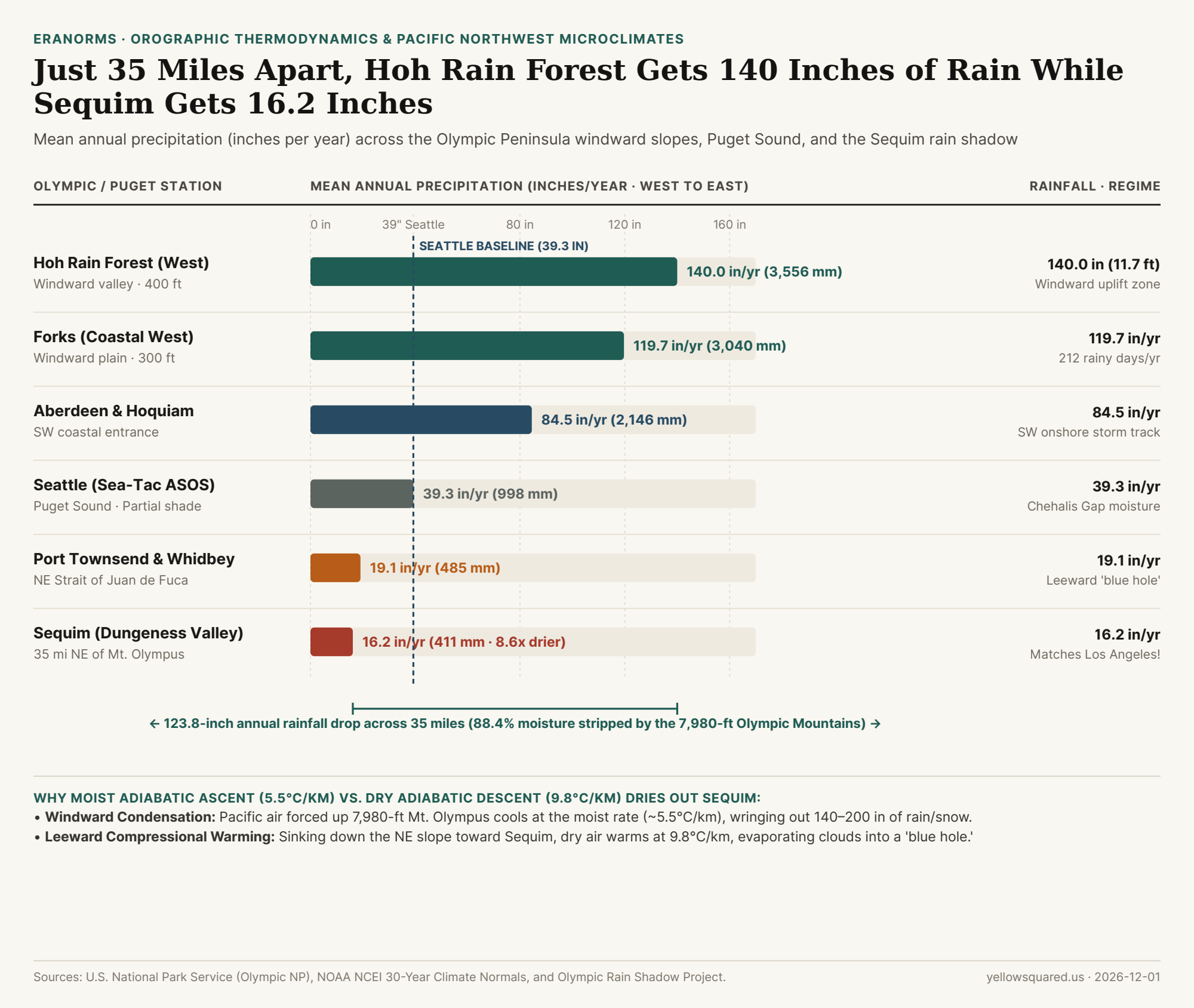
Stand beneath the Sitka spruces and bigleaf maples of the Hoh Rain Forest on the western flank of Washington's Olympic Peninsula, and you are standing in one of the wettest temperate rainforests on Earth, drenched by an average of 140 inches (11.7 feet / 3,556 mm) of precipitation every year—with another 200+ inches of snow water equivalent falling on the glaciers of 7,980-foot Mount Olympus just upslope. Now draw a straight line 35 miles (56 km) northeast across the crest of the Olympic Mountains to the farming town of Sequim, Washington: annual rainfall plummets by 88.4% to just 16.2 inches (411 mm), where farmers irrigate lavender fields and wild prickly pear cactus grows natively. That 8.6-to-1 moisture cliff across a single mountain massif is one of the sharpest examples on Earth of an orographic rain shadow.
Reader outcome: You will understand the exact two-stage lapse-rate physics (moist adiabatic cooling at ~5.5°C/km on the windward climb vs. dry adiabatic warming at 9.8°C/km on the leeward descent) that creates Sequim's "Blue Hole," and see how the Olympic rain shadow shapes rainfall across Forks, Sequim, Port Townsend, Whidbey Island, and Seattle.
The Thermodynamics of a Rain Shadow: Why Air Returns Warmer and Drier
During autumn and winter, prevailing North Pacific storm tracks drive mild, moisture-saturated air masses from the southwest (210° to 250°) directly into the Olympic Peninsula. Unlike the north-south Cascade Range, the Olympic Mountains form a steep, circular dome rising from sea level to 7,980 feet (2,432 meters) at Mount Olympus in less than 30 miles. When a saturated marine air parcel hits that barrier, it is forced through an asymmetric thermodynamic cycle:
- Stage 1 — Windward Orographic Lift & Moist Adiabatic Cooling (
~5.5°C / km): Forced upward along the Hoh, Queets, and Quinault river valleys, the air expands in lower atmospheric pressure and cools to its dew point within the first few hundred meters. Once saturated (`100% relative humidity`), condensing water vapor releases latent heat of condensation (`2,500 J/g`), which slows the cooling rate to the moist adiabatic lapse rate of roughly5.0°C to 6.0°C per kilometer(`~3.0°F per 1,000 ft`). Because cold air at `2,400 meters` holds a fraction of the water vapor of mild sea-level air (by the Clausius-Clapeyron relation, water-holding capacity drops ~`7%` per `1°C` of cooling), the clouds wring out120 to 200 inchesof rain and snow on the western slopes. - Stage 2 — Leeward Subsidence & Dry Adiabatic Warming (
9.8°C / km): Once the wrung-out air crosses the Olympic crest and plunges down the steep northeastern lee slopes toward Sequim, Port Angeles, and the Strait of Juan de Fuca, its liquid water has already fallen out as rain and snow. Because the descending air is now unsaturated, it compresses and warms at the full dry adiabatic lapse rate of9.8°C per kilometer(`5.4°F per 1,000 ft`). - The Net Foehn Heating & Cloud Evaporation Effect: Climbing
2.4 kmat-5.5°C/kmcools the parcel by13.2°C, but descending2.4 kmat+9.8°C/kmwarms it by23.5°C! The air arrives in the Dungeness Valley over Sequim significantly warmer and with plummeting relative humidity—literally evaporating overhead stratocumulus clouds into a sunny patch pilots call the Sequim "Blue Hole."
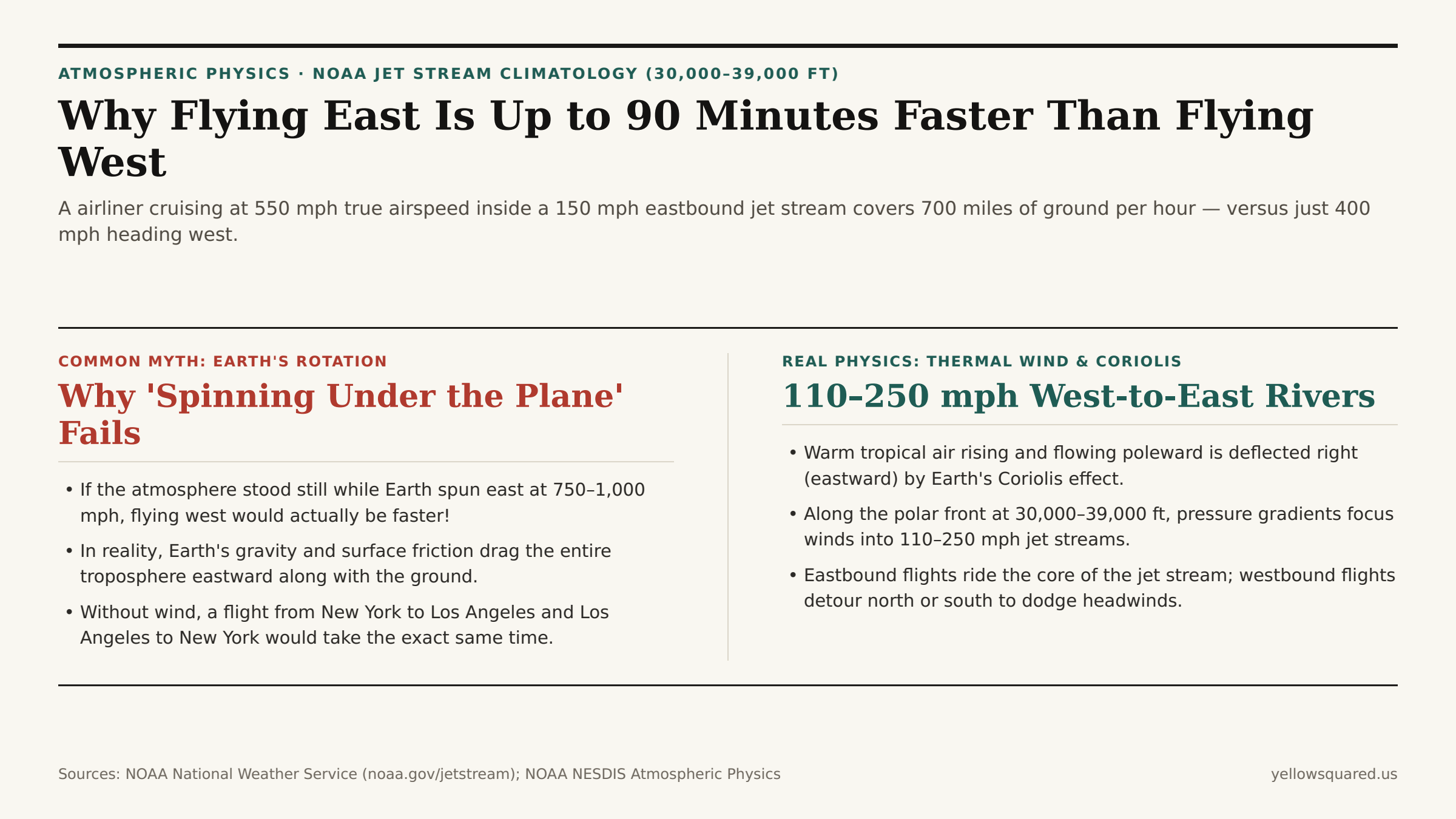
Rising wet air cools slowly (5.5°C/km) because condensing rain releases heat, but sinking dry air warms fast (9.8°C/km)—so air descending the leeward side of a mountain range evaporates clouds on contact.
Station-by-Station Transect: From 140 Inches in the Hoh to 16 Inches in Sequim
Because winter storm winds usually blow from the southwest, the deepest core of the Olympic Rain Shadow extends northeast of Mount Olympus across Sequim, Dungeness Spit, Port Townsend, central Whidbey Island (Coupeville), the southern San Juan Islands, and Victoria, British Columbia:
| Station / Location | Position vs. Olympics | Elevation | Annual Precip (in) | Annual Precip (mm) | Orographic & Thermodynamic Regime |
|---|---|---|---|---|---|
| Mount Olympus Snowfield | Windward Crest Peak | 7,980 ft (2,432 m) |
~200.0 in |
5,080 mm |
Maximum orographic lift & alpine glaciers |
| Hoh Rain Forest Station | Windward West Valley | 400–1,200 ft |
140.0 in | 3,556 mm |
Moist adiabatic ascent dumps 11.7 ft of rain |
| Forks & Bogachiel Valley | Windward Lowland | 300 ft (91 m) |
119.7 in |
3,040 mm |
Unblocked Pacific moisture (~212 wet days/yr) |
| Aberdeen & Quinault | SW Windward Gate | 40–300 ft |
84.5–130 in |
2,146 mm |
Initial coastal uplift of marine air mass |
| Seattle (Sea-Tac Airport) | Puget Sound Corridor | 433 ft (132 m) |
39.3 in |
998 mm |
Partial shadow + Chehalis Gap southwesterly flow |
| Coupeville (Whidbey Is.) | NE Leeward Core | 50–200 ft |
20.7 in |
526 mm |
Downslope adiabatic warming dries cloud deck |
| Port Townsend (Quimper) | NE Leeward Strait | 100 ft (30 m) |
19.1 in |
485 mm |
Sinking dry air creates sunny 'blue hole' |
| Sequim (Dungeness Valley) | Deep Leeward Shadow | 180 ft (55 m) |
16.2 in | 411 mm |
8.6x drier than Hoh; matches Los Angeles |
Why Seattle Gets 39 Inches Instead of 16 Inches (And the Puget Sound Convergence Zone)
If Seattle sits east of the Olympic Mountains, why does Sea-Tac Airport record 39.3 inches of rain per year instead of Sequim's 16.2 inches? Because winter storm winds blow from the southwest (~220°), the main shadow cone projects northeast over Sequim, Whidbey Island, and Victoria—whereas southwesterly winds slip around the southern flank of the Olympics through the low-elevation Chehalis Gap straight into Tacoma and southern Seattle. Furthermore, when westerly air splits around the north side (Strait of Juan de Fuca) and south side (Chehalis Gap) of the Olympics, the two airstreams collide over north King and south Snohomish counties (between North Seattle, Edmonds, and Everett), forcing air upward in the Puget Sound Convergence Zone (PSCZ). To compare daily precipitation, sunshine anomalies, and 30-year NOAA station normals across Washington and U.S. ASOS stations, Compare station weather against climate normals in Eranorms.